
FS03: Radiometric Thermal Survey
Thermal sensing techniques provide a powerful insight not only into heat loss & insulation for the built environment, but can also provide extremely valuable data into land and vegetation conditions. The use of sensing with drones provides enhanced benefits of resolution and coverage.
Sensing Principles
Radiometric thermal survey uses a band of electromagnetic wavelength of light in the infra-red bandwidth (typically 7.5um to 13.5um). However, unlike multispectral reflectance, the sensor measures emitted wavelengths using a thermal imager. All bodies emit thermal radiation as electromagnetic wavelengths (emission rates are higher in the far infra-red range) which allows us to measure the relative variations and determine the nature and condition of land, property or object.
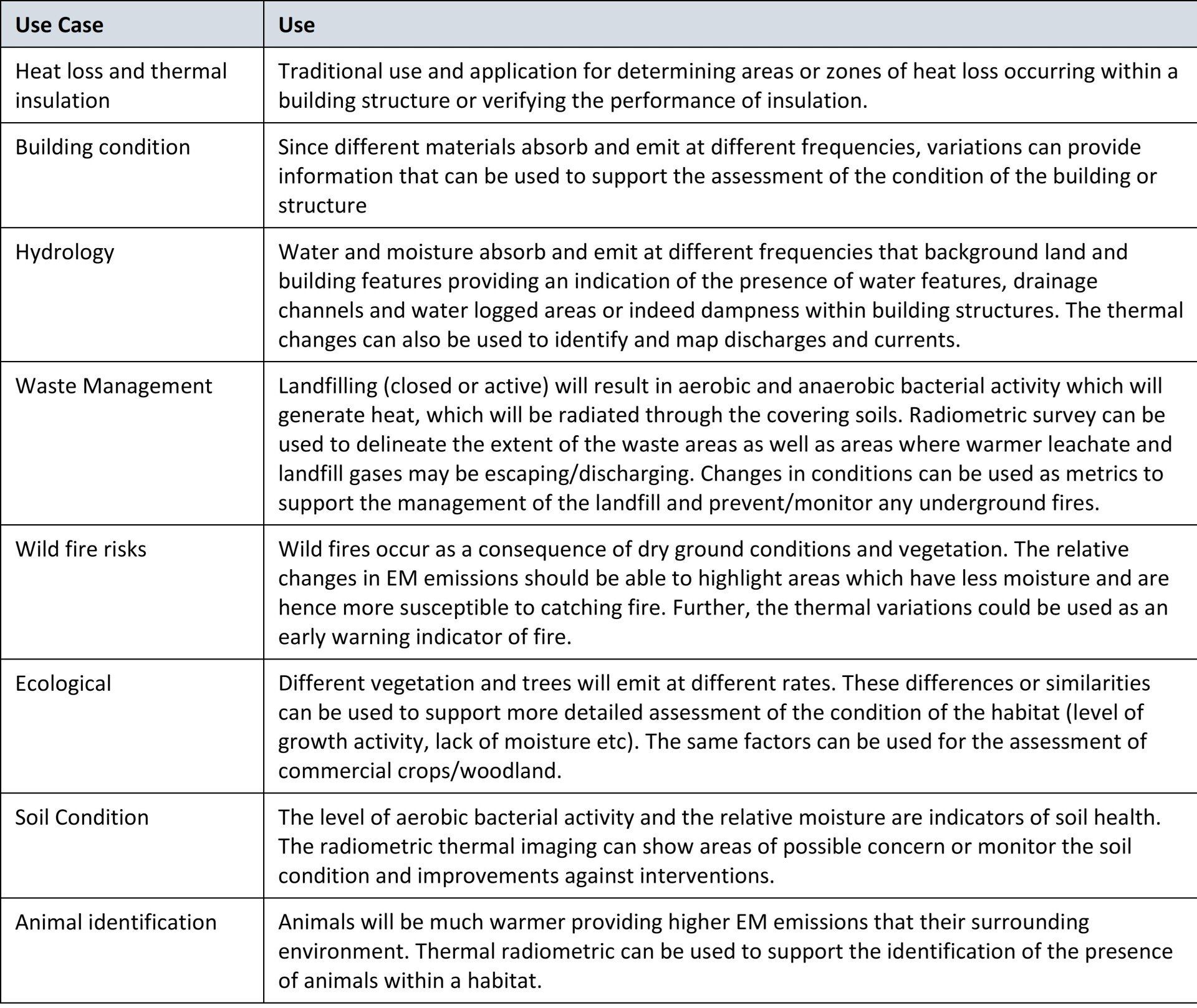
Why we use thermal survey
Radiometric thermal is traditionally used for assessment of heat loss within buildings. However, the differences in emitted electromagnetic radiation can also be particularly useful for a whole range of use cases in the assessment of land, property and infrastructure.
Surveying Processes
The survey process follows the same principles as that of photogrammetry. The key difference is that the field of view is smaller and the overlap between images typically needs to be greater. In addition, frequent calibration is required prior to each flight or mission and on completion of the mission flight using a calibration panels. The target helps ensure that we can accurately measure thermal variations.
Surveys should optimally be undertaken during early morning conditions where the background ambient conditions are most stable and where target measurements become more apparent. Thermal surveys can be undertaken in night conditions, but can be impacted at any time by factors such as rain, fog and ice.
Surveying Examples
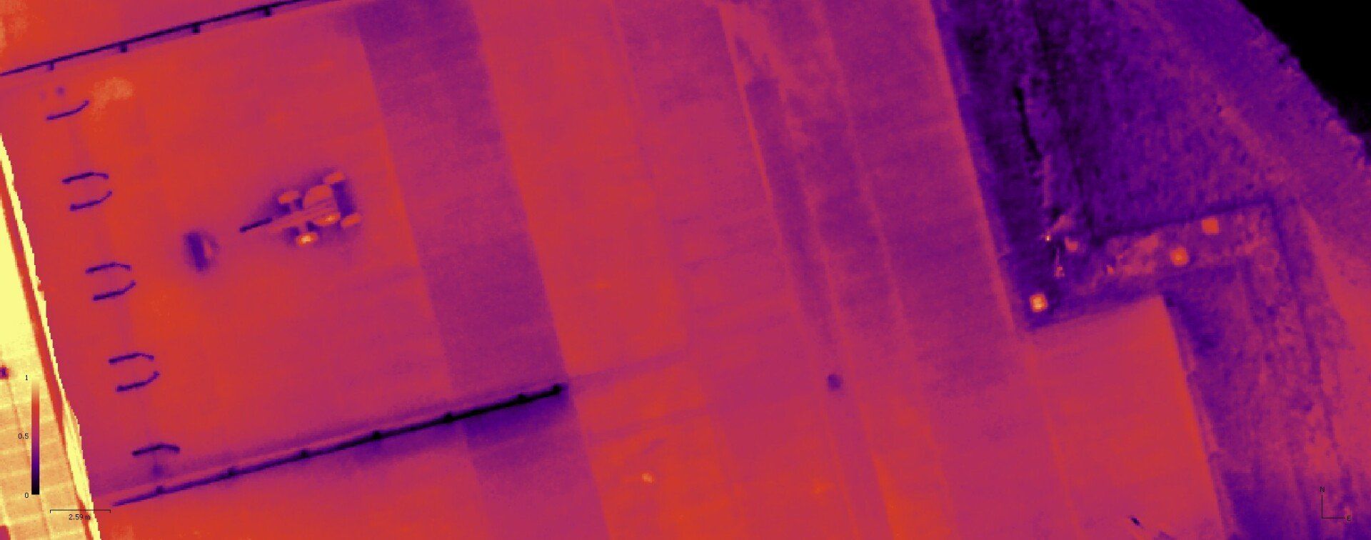
Building: Industrial estate assessment. Drainage covers can be readily identified, the concrete pours for the new yard area along with joint seems are apparent.
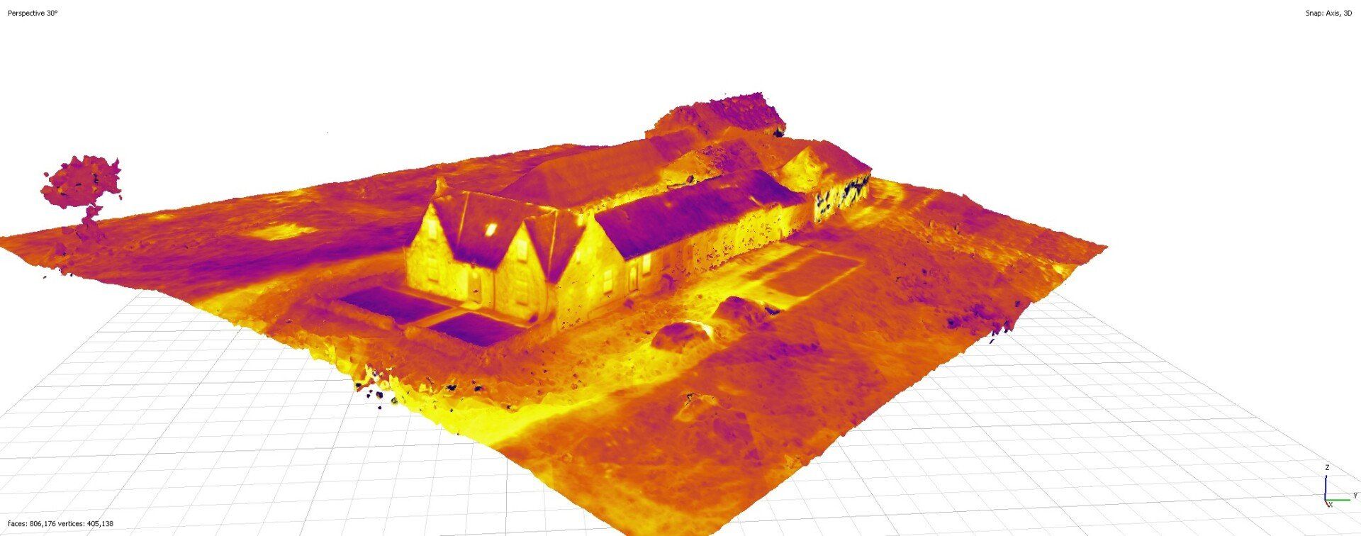
Building and Farmland: Orthomosaic of a thermal survey across farmland and farm buildings. The majority of the heat loss is from the upper level of the house and through the windows. The relative density of vegetation shown in the images from the surrounding fields. The road surfacing of bitumen and concrete has retained some absorbed heat from daytime.
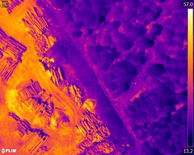
Forest Survey: Thermal survey across new forest plantation, old monoculture and biodiverse forest areas, including saw mill area. Images help support vegetation growth assessment.
Land Condition Assessment
For optimum results use radiometric thermal sensing with sensing with LiDAR, photogrammetry and multispectral survey. The data used from these various techniques using light can be used to cross reference and enhance the data outcomes, particularly where there are multiple or complex needs and requirements. Assessments can be enhanced further through the use of meteorological, temperature and moisture-based sensing/physical measurement techniques.