FS04: Gas Measurements
Gas detection, sampling and gas flux measurement and assessment innovations provide a very strong tool set in assessing atmospheric and climate change impacts.
Background
The measurement of gas concentrations in the atmosphere from leaks, discharges or emissions is important for managing and regulating industry, determining human health impacts and in the assessment of climate change. On the whole, atmospheric gases have been traditionally sampled from static ground based stations, portable measurement equipment or research aircraft. Until very recently, 3-dimensional measurement surveys have been impossible in the near-surface environment, or in areas where access is difficult or hazardous.
The use of UAVs as a highly versatile mobile atmospheric measurement platform is ground-breaking and evolving at pace. Sampling gas concentrations in 3-D from UAVs allow us not only to simply detect the presence of leaks but also to pinpoint their location and calculate gas emission rates (fluxes). Accurate knowledge and quantification of carbon dioxide and methane emission fluxes is a particularly new challenge for industries looking to account for, and reduce, their carbon emissions in response to Net Zero ambitions. Emissions calculated from UAV gas measurements can aid regulatory emissions reporting and accounting, and inform those looking to identify and mitigate often unnecessary and avoidable emissions. The reliability of the measurements for climate change evaluation is increasing significantly with the reporting of uncertainties.
Gas Measurement Principles
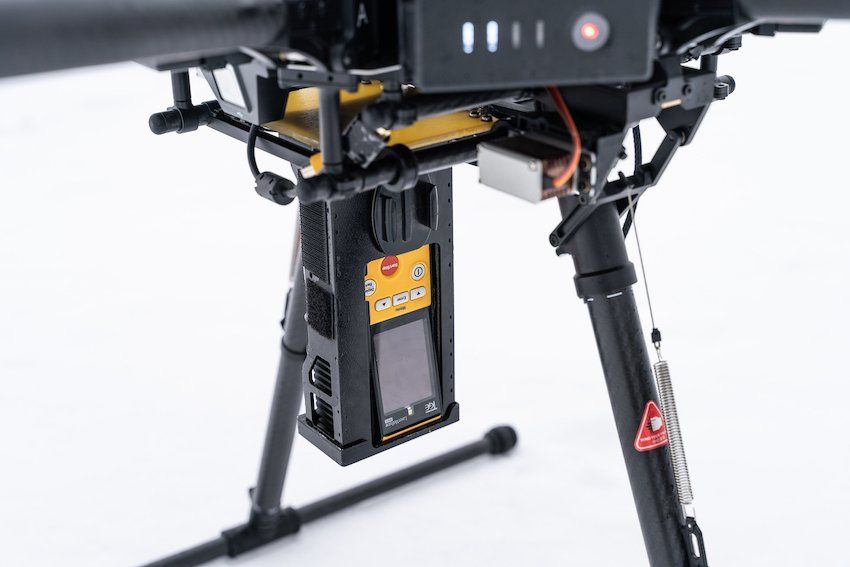
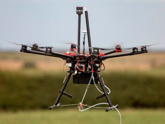
Drone platforms (rotary or fixed wing) can support evolving sensor technology suitable for the measurement of a range of gases (e.g. CH4, CO2, CO, N2O, NH3 etc) and particulate matter (PM10 and PM2.5). Drones also need to support atmospheric sensors to allow and support appropriate impact modelling and calculations. These include wind speed and direction, temperature, pressure and humidity. Importantly, the relative position of the drone is often critical to survey needs and will typically require Real Time Kinetics (RTK) or Post Processing Kinematics (PPK) as correction technologies for global positioning systems.
Accurate, calibrated and precisely geolocated sampling of atmospheric gas concentrations permit mapping of areas at scales of around 1km. This scale is highly suited to surveys of industrial sites, local urban environments, and smaller (point-scale source) industrial infrastructure. Sensor technology that can provide this high quality information include infrared and UV laser absorption spectrometers, metal oxide semiconductors, and photoionization detectors.
Gas Detection
UAV mapping surveys yield concentration heat maps that can help to locate the sources of any nearby emission and quantify the potential exposure of nearby populations and workers. When combined with atmospheric flow models such as Gaussian plume inversion and other dispersion modelling techniques, it is possible to pinpoint emission sources and assess impacts further downwind from survey areas. As use-case examples, this may be particularly important for local air quality impact assessment in sectors such as landfill, and for methane leak detection and repair (LDAR) in sectors such as oil and gas.
Gas Flux
The emission rate (or flux) of gas emitted from a source (or area) is a fast growing need, especially in the context of carbon accounting and Net Zero. The Paris Agreement and the COP26 Methane Pledge commit most developed countries to reducing emissions on defined timescales and lay the foundations for measurement-based emissions inventory reporting. Emissions reporting is a rapidly developing regulatory area, with a growing onus on polluting industries to accurately self-report to regulators. We have developed carefully validated models to quantify emission fluxes from UAV sampling of high-precision gas concentrations and simple atmospheric flow parameters such as wind speed and direction. Each UAV flight survey can provide a snapshot in time of emissions from a specific source or area. Repeated surveys can provide emission trend analyses, or impact assessment of mitigating interventions (e.g. carbon capture, or capping/scrubbing measures).
Meteorological
Thermodynamic measurements include wind speed and direction, pressure, temperature and humidity. These can vary significantly over small spatial scales due to local topography, buildings and other infrastructure. There is often a need to understand these micro-climates for risk assessment or planning. A specific example may be wind farm prospecting, where typical wind speeds and their vertical profiles may be important for estimating potential energy generation.
Gas Sampling
We have developed a unique process to obtain large whole gas samples from UAV surveys for offline laboratory analysis. This allows us an additional tool to support general verification of measurement data (note: sampling can occur throughout the time of flight, while sensors can be monitoring at high frequency). Sampling is typically undertaken as a task in its own right and obtained from a stationary drone or drone-in-flight depending on the required objective.
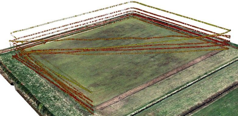
Surveying Processes
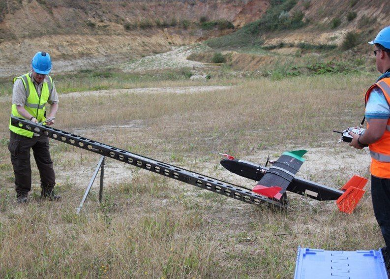
The flight management and sensor systems selection depend on the project objectives, range of gases to be assessed, requirement to integrate with existing ground based monitoring, and data communications requirements. Typically, larger or more linear areas are suited to measurements using fixed wing, while smaller or more irregular areas can be assessed using rotary wing platforms. Where there is a complex set of measurement requirements or where highly accurate data is required, then larger heavier lift rotary drones may be required, potentially operated alongside lighter drones in a swarm-coordinated flight path arrangement. In circumstances where longer timeframe measurements are required then drones can be tethered for continuous power, but are typically limited to sampling between 50 and 100m above ground.
Survey grade positioning may require the use of RTK with drones as well as likely requirements for ground control points and/or a ground control station. This is to support absolute accuracy of ground based detection along with drone positional accuracy for on board measurement.
Further ground truthing could be achieved using a controlled gas release of a reference gas to allow adequate calibration of the instruments and to refine modelling requirements. Much of the equipment may also require pre-survey calibration prior to use.
It is normally good practice to undertake a baseline land condition assessment of the
project area to inform land-based referencing and geo-located association with specific targets of interest. This includes the accurate positioning of any emission locations and features that may impact on gas detection or monitoring.
Surveying Examples
Flux Measurements: Measurement for GHG quantification
Landfill: Using a fixed wing drone platform to obtain methane and carbon dioxide gas detection measurements from a closed landfill site in the midlands.
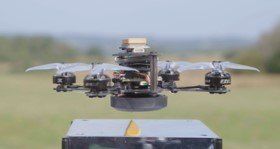
Gas Flux: Greenhouse gas measurement array on a specialised drone platform for research into gas flux from GHG.
Swarm Drone: D-TRIG autonomous swarm drone platforms for distributed systems for measuring urban air quality and meteorological conditions
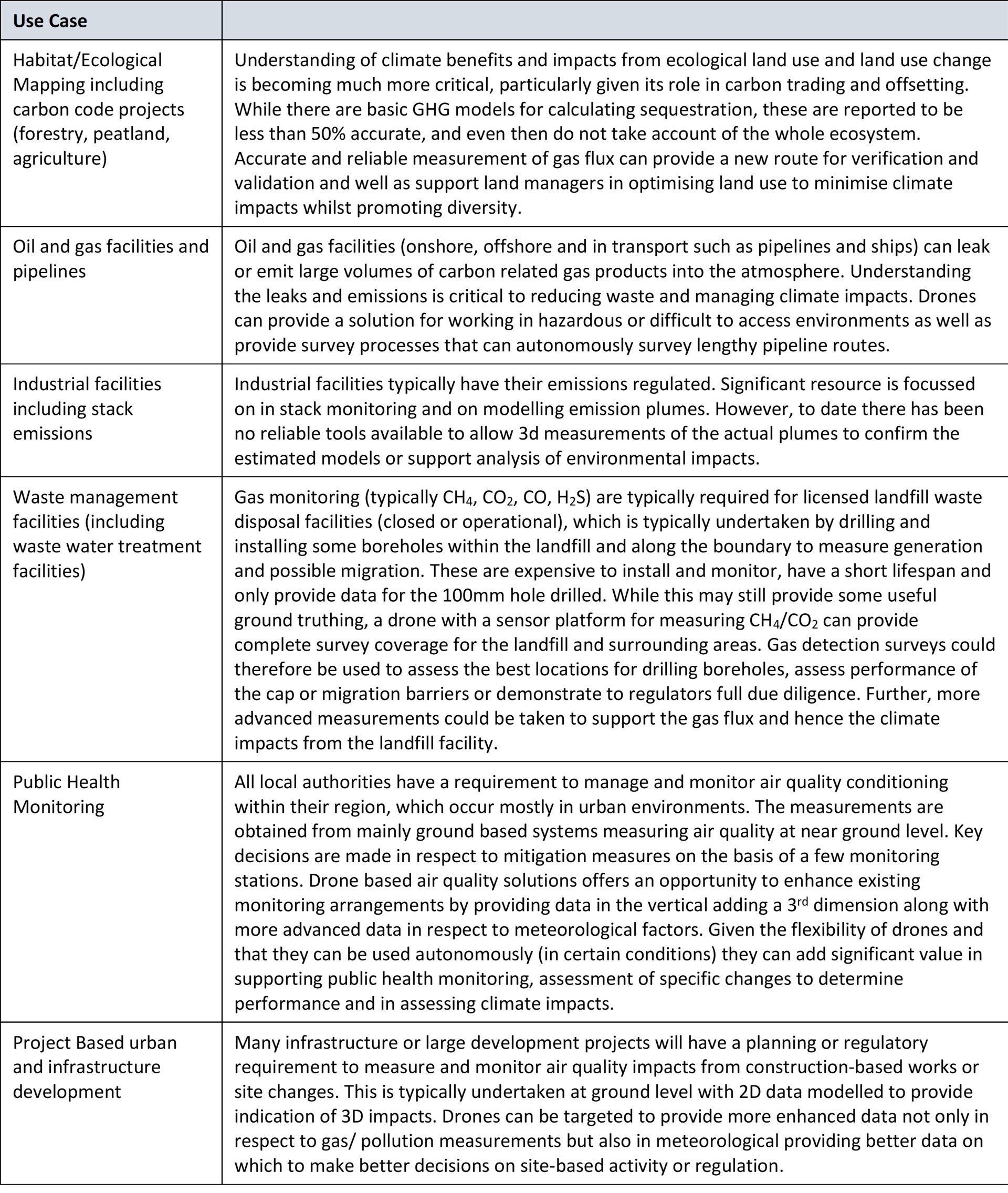
Use Case Applications
Gas measurement surveying can provide a range of benefits to various use case applications. The science and possibilities are increased significantly through the development of technology that allows drones to measure gases, pollutants and meteorological conditions.
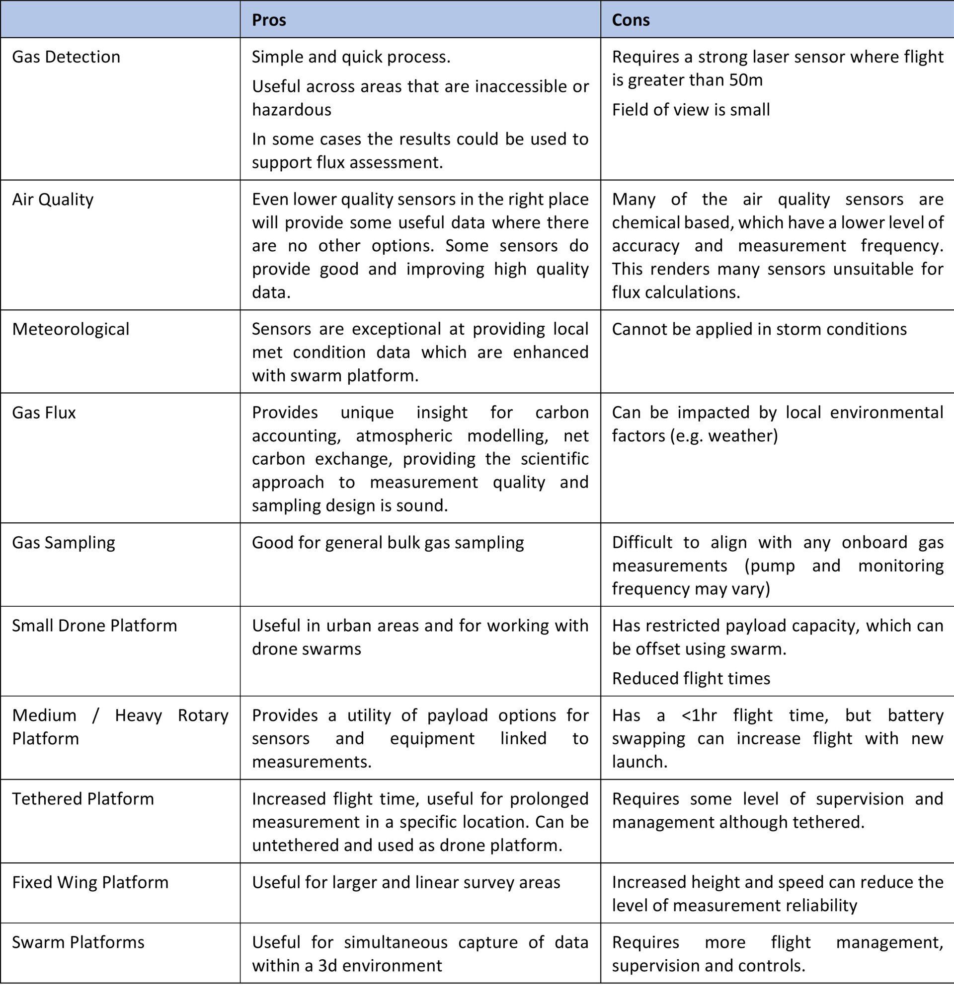
Advantages and disadvantages
Generally, gas detection, flux assessment and gas sampling are in their infancy. Yet the technologies for measurement, data capture and real time communications are improving rapidly, with each new use case application. The following is a summary overview of selected pros and cons from the various methods discussed.