New approaches to surveying farmland
Surveying large areas of farmland with specialist sensors, utilising hundreds of satellite and GIS datasets and application of games engine technologies is not the thing of the future, its happening now.
We have already explored and are, in fact, still exploring a number of specialist workflow solutions for farmers, land owners and estate managers. Farmers and landowners understand their land very well, after all they have lived and breathed the air, stalked across the muddy fields and watched daily the growth of their crops. However, with advancing technology we can now place a wholly new set of tools and solutions to help the farmers, land owners and estate managers balance efficiency, funding and their stewardship for our environment.
While we delve into our own toolbox of sensors it is apparent that each sensor solution may be able to provide a good insight into a farming area, but perhaps only a partial insight. However, by integrating the sensors or managing the data from multiple sensor technologies whilst using available satellite and GIS data provides a whole new frontier of valuable data. Putting this vast array of highly technical data into an accessible useable deliverable that is affordable and viable is quite challenging. We are up to an interesting challenge.
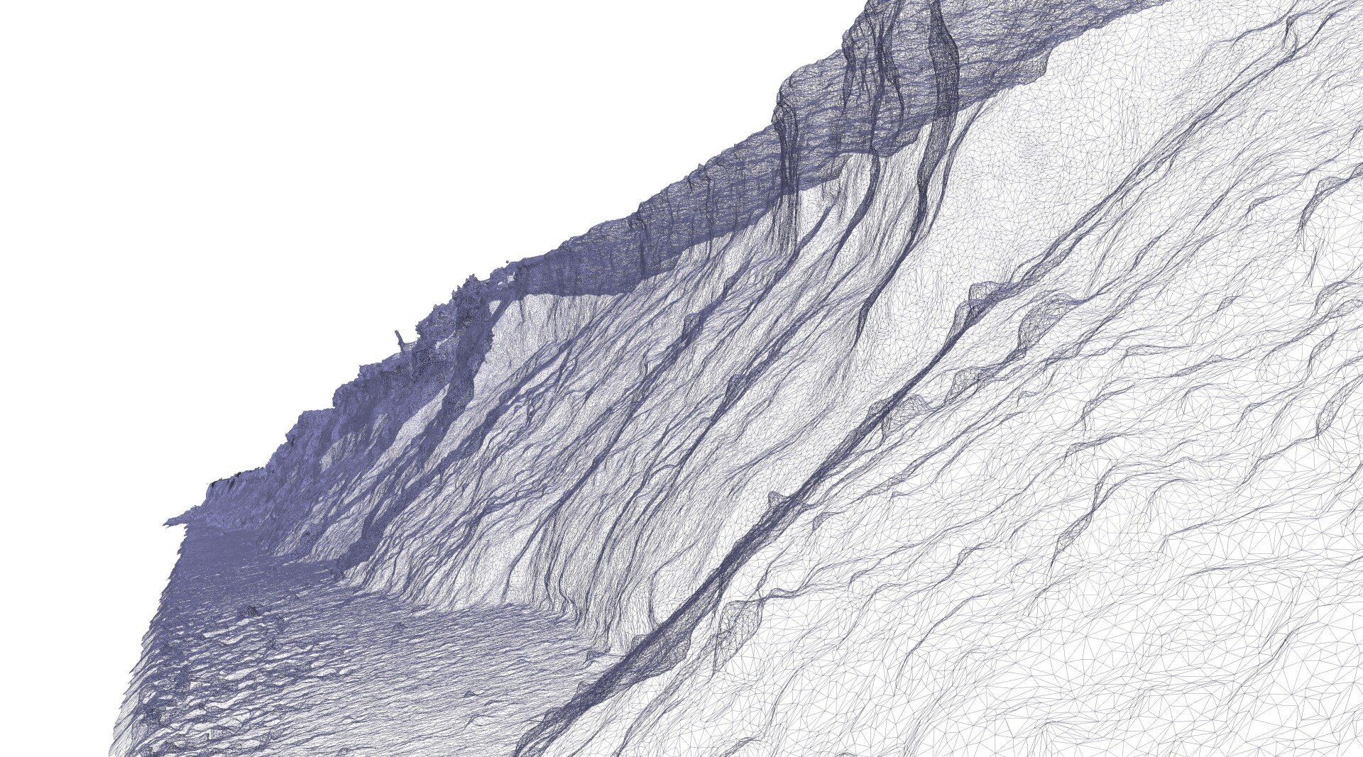
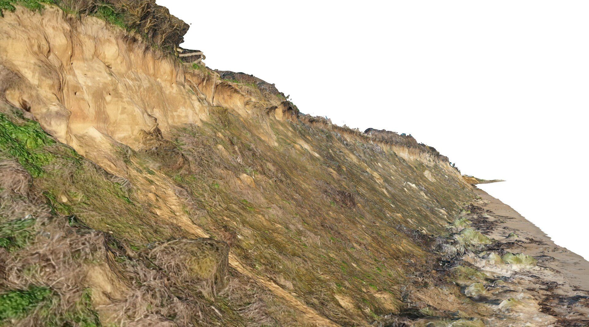
Proven technology sensors in support of typically high intensity farming includes basic photogrammetry and the use of multispectral sensors. Photogrammetry is essentially overlapping photography from a drone processed using advanced software to generate a point cloud, mesh, mosiac and then textured 3D model providing a reasonably good terrain model and visual representation of a farm/land area. Multispectral uses light sensing in specific bands (normally within 5 to 10 light band ranges, some beyond the visible spectrum) with different light bands representative of different features such as moisture, chlorophyll, crop health and geological features. The multispectral data can be used to show how well crops and vegetation are growing. More advanced assessments can be applied by using algorithms on relative light band absorbed, giving even more insight (NDRE, NDVI, OSAVI, CIR etc) on factors such as disease, moisture, relative growth rates and soil minerals.
This proven technology can be (relatively cheaply) significantly enhanced through comparison and assessment of existing datasets. There are two forms (a) curated data, typically held on GIS including everything from history, ecology/habitat, geology, hydrology, hydrogeology, soil maps, protected areas etc; and (2) observed data, typically from orbiting satellites that can serve up time sequenced terrain, multispectral and thermal datasets. Both can be set up as direct data feeds to a management system to provide better context and triage on decision making processes.
SurveyAR are in the process of exploration of additional sensing technologies from geophysics through to hyperspectral in a journey intended to give farmers and landowners much more insight. However, much of the focus is currently on the building of platforms (digital twins) that can be used effectively to absorb data feeds from current as well as survey or real time monitoring (or even forecasting) whilst providing a visual tool of accessible insight to the user and their stakeholders. All the sensing data on the planet is absolutely useless unless the user can access, use, understand, take action on it and then ultimately see the consequences of the action.